Have you ever found yourself stuck in Rawalpindi’s congested traffic, dreaming of a smoother, more efficient route to your destination?
If so, you’re not alone.
The burgeoning traffic woes in Rawalpindi have been a cause of concern for residents and commuters alike. However, there’s hope on the horizon.
This problem is NO MORE part of twin cities.
In this blog, we set out to provide you with the comprehensive insights you’ve been searching for – everything you need to know about the transformative project that promises to change how you navigate Rawalpindi: the Rawalpindi Ring Road. Whether you’re a resident or a curious traveler, this in-depth exploration will shed light on the project’s scope, impact, and the road ahead for this vital infrastructure development.
Rawalpindi: A transportation hub for Northern Pakistan
The urban areas of Islamabad and Rawalpindi play a crucial role in boosting Pakistan’s economy, and it is the third-largest metropolitan area by population. Roads and metro buses connect the two twin cities, but traffic and logistics make it difficult to navigate. The city of Rawalpindi is also a major logistics and transportation hub for northern Pakistan.
Our country’s major national transportation corridor is National Highway N-5, a 1,819 km long highway. The highway connects the country’s major economic and commercial centers, including:
- Karachi
- Lahore
- Islamabad
- Peshawar
- Torkham
Approximately 95 percent of exports and 65 percent of domestic traffic flow along this highway. The Rawalpindi Ring Road is designed to facilitate and reduce traffic congestion on the N-5 national highway.
Let's Make Your Real Estate Dreams a Reality
Contact Us
Let's Make Your Real Estate Dreams a Reality
Contact Us

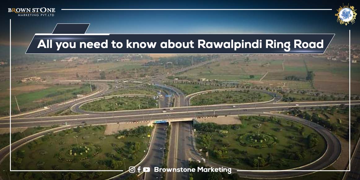
Rawalpindi Ring Road Construction Details and Map:
The ring road will have a length of 38.3 km and three lanes on each side (110 m in width). From Rawat, the Rawalpindi Ring Road leads to N-5 Sangjani. The project consists of eight interchanges:
- Adiya Interchange
- Sakhar Interchange
- Sarjani Interchange
- Chakbeli Interchange
- M2 Motorway Interchange
- Radio Pakistan Interchange
- Islamabad International airport Interchange
- Hakla DI Khan Interchange
Rawalpindi Ring Road has four service stations, two on each side. It will ease congestion on the N-5 and facilitate connectivity.
Ring Road Rawalpindi will also make commuting easy for the people of the twin cities. It will improve public transport and provide space for commuter vehicles in Rawalpindi’s central areas. The ring road significantly benefits residents of the peripheral regions. Moreover, it will reduce vehicular noise, air pollution, and fuel consumption for residents caused by traffic jams.
Rawalpindi Ring Road Location
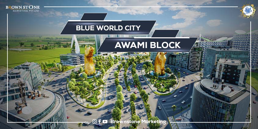
Ring Road Rawalpindi’s new plan and map indicate that the road will begin in Rawat (near the Radio Pakistan Tower) and pass through Adiyala Road, Chak Beli, Murat, and Chakri Road. At the Thalian Interchange, this route will be connected to the M-2. The proposed Ring Road of Rawalpindi will benefit specific communities, including Blue world City, DHA Phase 2, Bharia Town, and DHA Phase 3. One can easily reach Rawat just a few minutes through this route.
Rawalpindi Ring Road Design
Ring Road in Rawalpindi provides access to many areas.
- The road connects Rawat Rawalpindi to Adyala Road near Radio Pakistan via Bahria Town Phase 8 backside.
- Then it continues to the Sangjani interchange.
There will be eight interchanges on Ring Road.All interchanges cross through various areas, and they will all be serviced from the ring road. In addition, it crosses the Islamabad-Lahore and Islamabad-Peshawar Motorways. Therefore, access to the Motorway will be quick and easy.
RAWALPINDI RING ROAD INTERCHANGES
- CHAKBELI
- AIRPORT
- HAKLA – D.I KHAN
- ADYALA
- CHAKRI
- N-5 SANGJANI
- N-5 RADIO PAKISTAN ( THE NATIONAL HIGHWAY)
- M-2 MURAT (AT M-2 MOTORWAY)
RAWALPINDI RING ROAD FEATURES
- 100 OVERHEAD BRIDGES
- 6 FLY OVERS
- SATELLITE ZONES
RRR Major Aspects
RRR Phases
History
Since its announcement in 2008, the RRR has been divided into phases. A description of each stage is provided below.
Phase 1
The RRR was announced and planned more than a decade ago when the Punjab Province was ruled by the Pakistan Muslim League-Quaid (PML-Q). Mr. Chaudhry Pervaiz Elahi was Punjab’s chief minister at the time.
Rawalpindi Development Authority has been planning the ring road since 1997. Unfortunately, the project was never completed. Parvez Elahi’s government in Punjab conducted a new feasibility study in 2008 for Ring Road construction.
Previously, it was proposed that a private-public partnership be formed between foreign investors and the government to construct the ring road from Channi Sher Alam to Fateh Jhang next to the New Islamabad Airport. The project’s total length was 75km, and its total cost was estimated to be Rs 74 billion. Rawalpindi Development Authority changed the map and reduced the length to 54km.
These changes were made to minimize the project’s cost for the government to implement it using its resources. The Punjab government added ten new commercial and residential zones to the Rawalpindi Ring Road Economic Corridor (RRPEC).
Phase 2
The ring road under this phase (2010) was expected to be 70 km long and traverse all towns of Rawalpindi, allowing the rural areas to be connected with the town and cantonment.
However, the authorities explored ways of reducing the project’s total cost. To minimize the project’s cost, it was suggested that the road’s width or length could be reduced. In doing so, however, the objectives set for Ring Road would not be met.
RRR Current situation
Current Phase
In December 2021, the Executive Committee of the National Economic Council (ECNEC) approved the RRR project. The project was approved by the Executive Committee of the National Economic Council (ECNEC), chaired by the Advisor for Finance and Revenue, which included the construction of the main road from Baanth (N-5) to Thallian (M-2).
Conditions
The project was approved on the condition that the Planning Commission approves the project and the Axle Load Management regime is included. The project is estimated to cost Rs 23.6 billion. RRR has a total length of 38.3 km, approved by the present government. It will have six lanes.
Current phase route
The ring road route will start at National Highway (N-5) at Baanth (Rawalpindi district), pass through Chakbeli Road, Adyala Road, Chakri Road, and end at Motorway M-2 at Thallian Interchange.
Rawalpindi Ring Road Benefits
The government plans and executes every project for the benefit of the public. In this regard, the Government of Punjab designed Rawalpindi Ring Road, taking into account its many advantages, and they are as follows:
1. Network
The ring road will be the primary connectivity means between the twin cities. The master plan will link various integral points in the town. Rawalpindi Saddar is located a few minutes away from the Radio Pakistan interchange on the ring road. As a result, residents of the area will be able to drive to the twin cities more efficiently than ever before.
2. Economy
The RRR will also serve as an economic corridor for the country. By reducing traffic on the N-5, trucks carrying goods for trade can reach their destinations quickly. The ring road will improve transportation and reduce energy, time, and cost by serving as an economic corridor.
3. City Development
The construction of the RRR will result in urbanization. Various rural and less developed areas of the city will be linked through the master plan to urbanize them to prosper to their full potential, such as the Motorway areas, the Chakri side, etc. RRR will also help boost the development of upcoming under-construction residential projects in the twin cities.
Impact of Rawalpindi Ring road on real Estate
Housing societies or properties near the ring road enjoy high demand and price. Construction of the RRR will increase the costs of nearby properties once construction begins.
After the RRR construction, the communities near Islamabad and Rawalpindi will have much easier access. The Ring Road in Rawalpindi will allow travelers and residents of different housing societies to drive directly to their housing communities after entering Islamabad via the Motorway.
Rawalpindi Ring Road Advantages
Housing Societies Benefitting from Rawalpindi Ring Road
Many residential communities are currently under construction around the ring road. The approval and development of the RRR will consequently increase their prices, and the demand for these plots may increase.
The Rawalpindi Ring Road project is hovered to be a game-changer for nearby housing societies, including:
- Blue World City Islamabad
- DHA Islamabad
- Bahria Town Rawalpindi
- Capital Smart City
The following are some notable societies that will benefit from the RRR: